Microscopic Vehicular Mobility Trace of Europarc Roundabout, Creteil, France

The vehicular mobility dataset is mainly based on the real data collected by the General Departmental Council of Val de Marne (94) in France. The General Departmental Council of Val de Marne is a regional agency in charge – amongst other activities – of the transportation systems.

Different simulations tools and models are brought together to characterize and synthesize this trace:

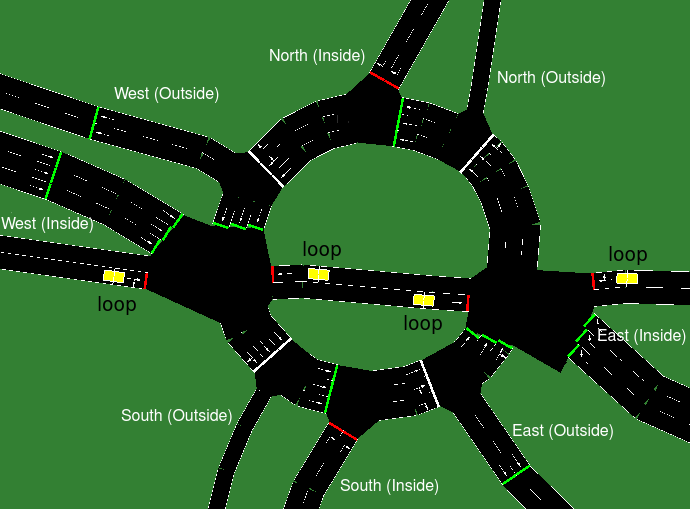
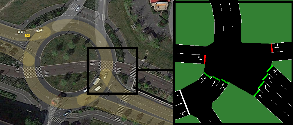
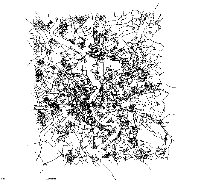
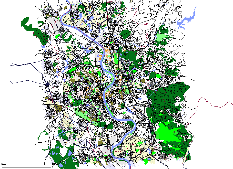
  • the street layout of Creteil roundabout area is obtained from the OpenStreetMap database,
  • the traffic demand information on the traffic flow is derived from car counting and camera video analysis,
  • the traffic assignment of the vehicular flows is performed by Gawron’s dynamic user assignment algorithm, included in the SUMO – Simulation of Urban MObility – simulator.
  • the traffic light mechanism is derived from sequence adaptation manually documented in the regional transportation system.

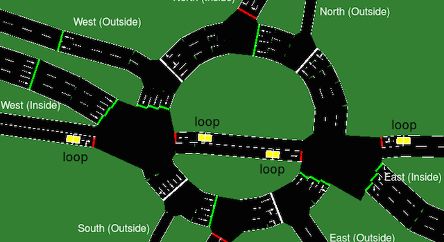
The resulting synthetic trace includes a roundabout with 6 entrances/exits, 2 or 3-lanes roads, 1 bus road, 4 changing-lane spots, 15 traffic lights. It comprises around 10000 trips, over rush hour periods of two hours in the morning (7AM-9AM) and two hours in the evening (5PM-7PM).

Contact

Frédéric Le Mouël


Vehicular Mobility Trace of the City of Cologne, Germany

The vehicular mobility dataset is mainly based on the data made available by the TAPASCologne project. TAPASCologne is an initiative by the Institute of Transportation Systems at the German Aerospace Center (ITS-DLR), aimed at reproducing, with the highest level of realism possible, car traffic in the greater urban area of the city of Cologne, in Germany.

To that end, different state-of-art data sources and simulation tools are brought together, so to cover all of the specific aspects required for a proper characterization of vehicular traffic:

  • The street layout of the Cologne urban area is obtained from the OpenStreetMap (OSM) database;
  • The microscopic mobility of vehicles is simulated with the Simulation of Urban Mobility (SUMO) software;
  • The traffic demand information on the macroscopic traffic flows across the Cologne urban area (i.e., the O/D matrix) is derived through the Travel and Activity PAtterns Simulation (TAPAS) methodology;
  • The traffic assignment of the vehicular flows described by the TAPASCologne O/D matrix over the road topology is performed by means of Gawron’s dynamic user assignment algorithm.

The resulting synthetic trace of the car traffic in a the city of Cologne covers a region of 400 square kilometers for a period of 24 hours, comprising more than 700.000 individual car trips.

Contact

Marco Fiore


An Event-Driven Simulator for Large-scale Wireless Sensor Networks (WSNET)

WSNet is an event-driven simulator for wireless networks. Its main features:

  • Node simulation: the simulated nodes are built as an arbitrary assembly of blocks which represent either a hardware component, a software component or a behavior/resource of the node.
  • Environment simulation: WSNet offers the opportunity to simulate physical phenomena (e.g. fire) and physical measures (e.g. temperature, humidity). These values can be read by the nodes, evolve in time, and the physical phenomena can impact the nodes, such as destroying them.
  • Radio medium simulation: WSNet has been designed to offer a wide range of radio medium modeling, from a basic ideal physical layer with no interference, no path-loss and a fix radio range to a complex and precise one with a Friis propagation formula, Rayleigh fading, multiple frequencies and complex correlation properties between frequencies, bpsk modulation, complex antenna radiation patterns, etc.
  • Extensibility: Node, environment, and radio medium blocks are developed in independent dynamic libraries. In consequence, the addition of new models does not require to modify the core of WSNet and can be done easily.

Contact

Hervé Rivano