Loukas Duque is giving a tutorial on QuaDRiGa : https://quadriga-channel-model.de
The seminar will take place on _Thursday February, 12 at 2pm room TD-C ; Lamarr Building
Loukas Duque is giving a tutorial on QuaDRiGa : https://quadriga-channel-model.de
The seminar will take place on _Thursday February, 12 at 2pm room TD-C ; Lamarr Building
The defense will take place on February 26, 2026
Title
Reinforcement Learning for Mobility Optimization in Wireless Sensor Networks: Application to Pollution Monitoring Using Drone Fleets
Abstract
Atmospheric pollution remains a major environmental and public health challenge, affecting both large urban areas and industrial zones. While chronic pollution results from persistent long-term emissions, accidental pollution—caused by sudden events such as chemical leaks or explosions—requires precise monitoring and rapid intervention to mitigate its impacts. Traditional methods, including fixed monitoring stations and satellite observations, provide high-quality measurements for continuous and large-scale pollution monitoring. However, their limited spatial and temporal resolution makes them insufficient for detecting and tracking accidental pollution events, which evolve rapidly in both space and time.
To overcome these limitations, research has increasingly focused on the use of sensors embedded in mobile robotic platforms, notably Unmanned Aerial Vehicles (UAVs). These systems offer unprecedented flexibility and active sampling capabilities, enabling the collection of high-resolution spatio-temporal data in areas that are inaccessible or pose high risks to human operators. Advances in sensors and robotics, combined with recent developments in artificial intelligence—particularly Deep Reinforcement Learning (DRL)—have significantly transformed autonomous UAV control. By integrating path planning and intelligent decision-making, these approaches enable adaptive, multi-agent monitoring, simultaneously optimizing coverage, responsiveness, and operational robustness.
This convergence of low-cost sensing, robotics, and DRL motivated the research in this thesis, which explores this synergy to design autonomous systems for real-time mapping of dynamic phenomena, such as accidental pollution plumes. The contributions lie at the intersection of spatio-temporal modeling and multi-agent planning, aiming to optimize mapping quality as well as the deployment and redeployment of mobile agents. They are organized around two main axes: (1) a DRL approach coupled with a probabilistic Gaussian Process model for active mapping, where a fleet of UAVs learns to explore the most informative areas based on uncertainty-reduction rewards and incorporates connectivity constraints to ensure reliable inter-UAV communications; and (2) a DRL approach combined with data assimilation, designed to improve both the accuracy and speed of mapping while accounting for communication constraints and the dynamics of the observed phenomenon.
This thesis introduces a new modular framework that combines the spatio-temporal modeling of dynamic phenomena with real-time anticipatory path planning for cooperative UAVs. By jointly optimizing informativeness and communication through DRL, our approach provides a monitoring strategy that is both robust and generalizable.
Jury
– M. Marcelo DIAS DE AMORIM, Directeur de Recherche – CNRS – Rapporteur
– M. André-Luc BEYLOT, Professeur des Universités – Toulouse INP / ENSEEIHT – Rapporteur
– Mme. Isabelle GUERIN-LASSOUS, Professeure des Universités – Université Claude Bernard Lyon 1 – Examinatrice
– Mme. Christelle CAILLOUET, Maîtresse de Conférences (HDR) – Université Côte d’Azur – Examinatrice
– M. Grégoire DANOY, Chercheur Scientifique (HDR) – Université de Luxembourg – Examinateur
– M. Walid BECHKIT, Maître de Conférences (HDR) – INSA-LYON – Directeur de thèse
– M. Hervé RIVANO, Professeur des Universités – INSA-LYON – Co-directeur de thèse
Speaker
Marc-Olivier Killijian
https://kirija.github.io/
Title
les avancées du chiffrement homomorphe appliqué au machine learning
When / Where
Monday, December 1st at 10.
Bibliothèque Marie Curie, 31 avenue Jean Capelle 69621 Villeurbanne.
Salle Créativité 202/203
Abstract :
Au cours des dernières années, la communauté du chiffrement homomorphe a franchi un cap décisif : le développement du functional bootstrapping dans les cryptosystèmes de type TFHE a transformé le paysage de la cryptographie appliquée au machine learning. En permettant d’évaluer efficacement des fonctions non linéaires
— longtemps considérées comme l’un des goulots d’étranglement fondamentaux du calcul chiffré — ces avancées offrent aujourd’hui la possibilité de transposer, presque sans compromis, des primitives d’apprentissage automatique dans un cadre entièrement chiffré.
Dans ce séminaire, il dressera un panorama de ces progrès et illustrerai, à travers trois contributions récentes, comment ces nouvelles briques cryptographiques ouvrent la voie à une véritable chaîne complète de machine learning sécurisé :
– Inférence chiffrée grâce à PROBONITE (WHAC’22), une des première méthode non-interactive permettant la traversée d’arbres de décision sous chiffrement en exploitant les opérations de comparaison dérivées du bootstrapping programmable.
– Apprentissage chiffré, avec BlindSort et Private k-NN (PETS’25), qui montrent comment exploiter les LUT homomorphes et les opérations inconscientes pour trier, agréger ou classer des données sensibles sans jamais les déchiffrer.
– Dés-apprentissage chiffré, présenté pour la première fois dans notre travail en cours, qui démontre qu’il est désormais possible de supporter de l’exact unlearning d’arbres de décision sous TFHE, de manière inconsciente, c’est-à-dire en rendant indiscernables les requêtes de formation, d’inférence et de dés-apprentissage.
Ces trois résultats illustrent une vision unifiée : l’utilisation de primitives comme le programmable bootstrapping, les LUT chiffrées ou les opérations d’accès aveugle (blind access) permet de dépasser la simple inférence privée, longtemps considérée comme l’horizon du FHE, pour aller vers des modèles réellement dynamiques, adaptatifs et conformes aux exigences modernes de protection de la vie privée — incluant notamment le droit à l’effacement.
Il conclura en discutant les perspectives offertes par ces nouveaux paradigmes, leurs défis pratiques et les questions ouvertes pour le déploiement de systèmes d’apprentissage machine complètement chiffrés, sûrs et auditables.

The defense will take place on friday 28th of november at 2 PM.
Room: TD-C ; Hedy Lamarr building
Title
Spatio-temporal Synchronization & Signal Processing for Zero-Energy Digital Twins in Ambient Backscatter Communication Systems.
Dr. Carlos Jaime Barrios, member of Citi lab, is the new President of the SIGHPC Computing Continuum ACM Chapter, since August 1, 2025.
More informations here : https://scalac.redclara.net/en/component/content/article/178-new-president-of-the-sighpc-computing-continuum-acm-chapter?catid=93&Itemid=437
Speaker
Maud Rio
https://pagesperso.g-scop.grenoble-inp.fr/maudrio/
When / Where
6th February 2025, Amphi Chappe, Heddy Lamarr building INSA Lyon, Villeurbanne
or
https://insa-lyon-fr.zoom.us/j/96963106419?pwd=a2puTTFocTB2R0MwaENNbXAvYlBFQT09
Title
“Comment intégrer les enjeux permacirculaires en recherche et en conception en ingénierie ? ”
Speaker
Samuele Zaboli : https://samuelezoboli.github.io/
When / Where
18th February 2025, “salle vitrine”, Heddy Lamarr building INSA Lyon, Villeurbanne
Title
Control-informed neural policies for multi-agent systems

Speaker
Sheng YANG
When / Where
13th February 2025 ; room TD-C ; Heddy Lamarr building INSA Lyon; Villeurbanne
This seminar is open to everyone and is recognized by the EEA doctoral school for doctoral training hours. We will have a sign-in sheet for PhD students who wish to attend the seminar (in person).
visio
https://insa-lyon-fr.zoom.us/j/92678255340<https://insa-lyon-fr.zoom.us/j/92678255340>
Title
From Bayesian Statistics to Large-Scale MIMO Communications
Abstract
Large-scale MIMO systems have emerged as a cornerstone for next-generation wireless communication networks. While extended research has been conducted on signal processing and transceiver design in these systems, the fundamental Shannon capacity limit remains elusive in many settings, particularly in the presence of system non-linearities. In this talk, we explore the connection between statistics and communication, and introduce a novel approach that leverages information-theoretic asymptotics from Bayesian statistics to derive the Shannon capacity of such systems. We reveal the critical role of the Fisher information and Jeffreys’ prior in this characterization, and
demonstrate how to apply this method to derive the asymptotic capacity of various channel models. Examples include the MIMO channels with 1-bit ADC, clipping, phase noise, and imperfect channel state information.
Biography
Sheng Yang received the B.E. degree in electrical engineering from Jiaotong University, Shanghai, China, in 2001, and both the engineer degree and the M.Sc. degree in electrical engineering from Telecom ParisTech, Paris, France, in 2004, respectively. In 2007, he obtained his Ph.D. from Université de Pierre et Marie Curie (Paris VI).
From October 2007 to November 2008, he was with Motorola Research Center in Gif-sur-Yvette, France, as a senior staff research engineer.
Since December 2008, he has joined CentraleSupélec, Paris-Saclay University, where he is currently a full professor. From April 2015, he also holds an honorary associate professorship in the department of electrical and electronic engineering of the University of Hong Kong (HKU).
He received the 2015 IEEE ComSoc Young Researcher Award for the Europe, Middle East, and Africa Region (EMEA). He was an associate editor of the IEEE transactions on wireless communications from 2015 to 2020.
He is currently an associate editor of the IEEE transactions on information theory.
The defense will take place on november 25 at 9 AM
Title
Learning spatial representations for single-task navigation and multi-task policies
Abstract
Autonomously behaving in the 3D world requires a large set of skills, among which are perceiving the surrounding environment, representing it precisely and efficiently enough to keep track of the past, making decisions, and acting to achieve specified goals. Animals, for instance humans, stand out by their robustness when it comes to acting in the
world. In particular, they can efficiently generalize to new environments but are also able to rapidly master many tasks of interest from a few examples. We will study how artificial neural networks can be trained to acquire a subset of these abilities. We will first focus on training neural agents to perform semantic mapping, both from augmented supervision signal and with proposed neural-based scene representations.
Neural agents are often trained with Reinforcement Learning (RL) from a sparse reward signal. Guiding the learning of scene mapping abilities by augmenting the vanilla RL supervision signal with auxiliary spatial reasoning tasks will help navigate efficiently. Instead of modifying the training signal of neural agents, we will also see how incorporating specific neural-based representations of semantics and geometry within the architecture of the agent can help improve performance in goal-driven navigation. Then, we will study how to explore a 3D environment to build neural representations of space that are as satisfying as possible based on robotic-oriented metrics we will propose. Finally, we will move from navigation-only to multi-task agents, and see how important it is to tailor visual features from
sensor observations to the task at hand to perform a wide variety of tasks, but also to adapt to new unknown tasks from a few demonstrations.
Jury
* Ivan Laptev, Directeur de Recherche (INRIA Paris / MBZUAI), Rapporteur
* Karteek Alahari, Directeur de Recherche (INRIA Grenoble), Rapporteur
* Nicolas Thome, Professeur des Universités (Sorbonne Université), Examinateur
* Georgia Chalvatzaki, Full Professor (TU Darmstadt), Examinatrice
* Laëtitia Matignon, Maître de Conférences (UCBL), Co-Directrice de thèse
* Olivier Simonin, Professeur des Universités (INSA Lyon), Co-Directeur de thèse
* Christian Wolf, Principal Scientist (Naver Labs Europe), Co-Directeur de thèse
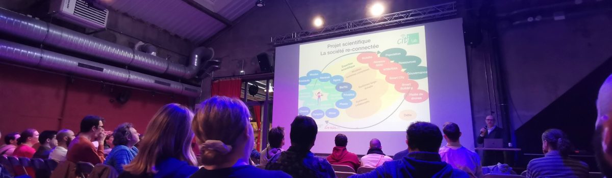
On Thursday, October 24th, the teams of the CITI laboratory gathered at La Commune (Lyon 07) for their welcome day. It was an opportunity to review the laboratory’s roadmap and introduce the new faces, including the BioTic team, which will soon be joining the laboratory.
For more information : https://intranet.insa-lyon.fr/actualites/le-laboratoire-citi-fait-sa-rentree